Last week, James and I attended an Environmental Consultants Association (ECA), Environmental Institute of Australia and New Zealand (EIANZ) and Department of Parks and Wildlife (DPaW) joint workshop on fauna assessment for the Environmental Impact Assessment (EIA) process, where I gave a talk about “hand held mobile data collection devices”. It was great to be back amongst the fauna survey community; I still have a lot of fond memories of my days in the field doing surveys.
Over time, Gaia Resources has been involved in a wide variety of field data collection projects with different clients from a wide range of client bases, so I think we’re pretty well suited to be able to comment on this area. The talk I gave is embedded below, and it might not be quite what you were expecting.
I struggled with this talk, because as my bio stated, I am a technology junkie. While I firmly believe that mobile data capture can help fauna surveys, this will require investment from the survey practitioners to develop tools that are tailored to the different workflows that they use (and in this climate, sometimes that’s hard to justify). This is also plagued by the expectation that we see a lot – that technology is a “magic bullet”, and this isn’t the case.
The workshop wasn’t just about technology, though. We had talks from the regulators, from practitioners and from solution providers like ourselves; there were also some interactive elements like workshops on survey methodologies for threatened species. For me the highlights included some direction from the Office of the Environmental Protection Authority, an update on the Western Australian Biodiversity Science Institute and the innovative technology talks on thermal cameras, acoustics and drones (spot the technology junkie again?). It was also great to talk to a range of practitioners around our support for Quantum GIS (including our training courses, one of which is coming up soon – stay tuned), and other work that was relevant. And, I had a very pleasant trip back down memory lane along the way.
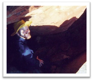
Back in the day, I was once employed to do field surveys myself. I am by no means an expert in anything but as a generalist I have an interest in a lot (as a few of my Facebook friends will have seen from my latest forays into fungi identification). But I was taught some very robust techniques and what to consider in terms of survey from some very experienced biologists from Biota and the Western Australian Museum. Along the way I learned a lot about survey techniques and what to consider – except how bad that yellow hat was.
Yep, that’s a younger version of me, disappearing into a rock pile in the Pilbara in the “good old days”
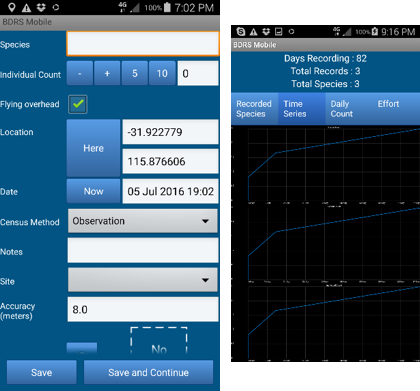
Anyway, back to technology -I use a custom mobile app that we built in-house for my own bird surveys, and I love using it. It has been tailored for my own use; for example, the autocomplete field for species names means that my data entry is about as fast as I think you can make it on a mobile device. The fields on the form are arranged in such a way that I can enter the name, number if they are transient (e.g. flying overhead – these are things that might not be actually using the habitat I am surveying) and then hit “Save and Continue”. The forms take care of the time, date, location (to a defined accuracy) all automatically, and I end up with very detailed point dataset of all of my sightings. In addition, I flick out of the recording form regularly to view the species accumulation curves I’m getting to see if I’m starting to tail off on the curve or if I still have a way to go (something you inherently know, but this does help to make you think about it).
Example screenshots from the internal app I use for birding
I haven’t been birding for a while now, so when I’m in this “rusty” state for field identifications, the time it takes me for data entry is a small fraction of the time I spend searching and trying to identify those Small Brown Jobs (SBJs) or that faint call I just heard. So for me, this is a robust data entry mechanism that can keep up with me – but I’ll readily admit I can easily get out-data-entered by someone who can immediately do their identifications who is armed with a trusty notebook and pencil. But I know I can create a species list or site map from all my digital data much quicker than they can (and usually when Dad and I go for a survey, we check those out in the car or cafe afterwards)! The back end system that you use with your field data collection can really add to the success of the field work.
This experience means that at Gaia Resources we look at the problems that clients bring to us and we look at how we can holistically help them solve their problems with technology – and sometimes the best thing we can do is to tell them to wait, or that we don’t have the magic bullet that they are looking for. However, I’m pretty sure in the near future we’ll be rolling our new solutions for the environmental consulting industry, based off a range of things that James and I saw at the workshop.
If you want to have a chat about some of the tools that I mentioned in my talk for field data capture, or how we can help your organisation with tools like QGIS, then feel free to call (08 92277309), email me or start a conversation with us via Facebook, Twitter or LinkedIn.
Piers


Comments are closed.