In the last weekend of July, New Jake, Tony, Voon-Li and I (with some cameos from Old Jake and Serge) made our way down the Terrace to Spacecubed to participate in a weekend hackathon called AgHack. In a nutshell – we were amazed at what we accomplished in two days! An offline mobile mapping app, a hook-in to our GRID product, new satellite imagery services and sensor arrays!
So, what’s a hackathon?
It’s this slightly crazy concept where a big organisation with business challenges – relating to technology or data – opens up to the wider technology community to help them, in the hopes that a fresh pair of eyes might give them that innovative spark and the beginnings of a solution. The involvement is limited to a weekend in most cases, with intensive ideation, concept development, data crunching and programming brought to bare. A bit like a marathon (from where it gets its trendy name) participants stretch themselves to the limit and come away from the event pretty exhausted. Also like a marathon, there can be many winners apart from the ones who bring back the ‘trophy’.
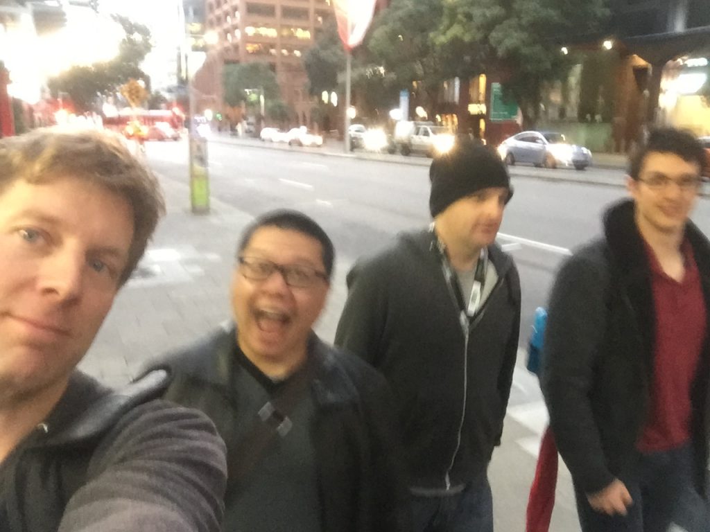
The brave souls of the Gaia hackathon team making their way down the terrace, blissfully unaware of the punishment ahead.
Aghack was hosted by the Ministry of Data (MoD), sponsored by the Department of Primary Industries and Regional Development (DPIRD) who supplied the challenges, mentors and heaps of data resources) and SPUR (who also supplied a mountain of data resources):
“The team from SPUR, powered by Landgate, have been supporting events like MoD for several years now by coordinating access to open data from government; and providing technical help for hackathon teams. We’ve learned a lot about how to help people get their ideas off-the-ground; and we’re expanding our offerings to include simpler licensing, grants and shared office space to assist innovators and start-ups.” Damian Shepherd
There were financial prizes for the teams who came up with the best pitch of their hackathon prototypes, and a bunch of minor prizes focused on supporting startups. For us it wasn’t so much about winning the prizes. We were looking at it as a chance to learn about DPIRD’s business challenges – having a coversation with different units within an existing client of ours was a big reason to head along. It was also about learning some new techniques and tools around software engineering and data analysis. Finally, you wouldn’t give up the majority of your weekend without hoping it would be a bit of fun! On this front we didn’t quite know what to expect.
Out of the eight challenges put forward – some about tracking sheep and grading grain, others about pest detection and farming optimisation – we settled on the one that we had a little bit of experience in: Monitoring the Rangelands. One of our Natural Resource Management (NRM) clients is Rangelands NRM, and we’ve spent several years supporting their important work through hosting, data management and analysis services.

 The Rangelands makes up about two-thirds of the State of Western Australia – the scale of which makes monitoring a challenge no matter how you slice it. (Image source: Rangelands NRM)
Right off the bat though we knew the challenge was really broadly framed – there were themes of “using remote sensing data,” “better management decisions,” and “quality and condition of pastoral land for sustainable grazing” but it was light on specifics. So we reached out to our friends at Rangelands NRM to get their perspective. What does Rangelands Monitoring mean to them? What do they think is the real challenge here – apart from the fact the Rangelands region is massive in scale. What could we knock up in a weekend that would be the beginning of something truly useful?
They gave us some insight into how there is already a lot of technology and data available to pastoralists and DPIRD but not much that brings both the regulator and the land manager together. What we needed was a common view. I latched onto a couple themes here: collaboration and knowledge sharing.
There were other helpful hints – a recent Auditor General’s report sighted “declining Rangelands condition” and the need for a “comprehensive system that made better use of remote sensing” and included “lease level monitoring.”
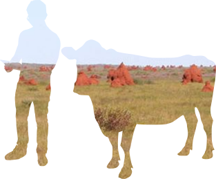
We bring you…. Rangelands Rover
Images sourced from RangelandsNRM
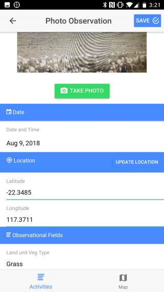
We focused on a simple-to-use mobile mapping app – which we called “Rangelands Rover” – that collects local information and sends that directly to an instance of GRID, our easy-to-use online GIS for NRM organisations, so that DPIRD can build up a better understanding of the condition of the Rangelands. The information that is captured by the app includes:
- geotagged photographs,
- condition assessments (e.g. Excellent, Good, Fair, Poor)
- environmental factors (e.g. erosion, fire etc.),
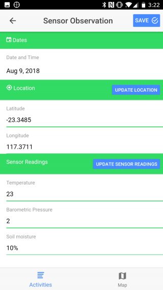
- sensor readings (e.g. temperature, humidity, soil moisture etc.)
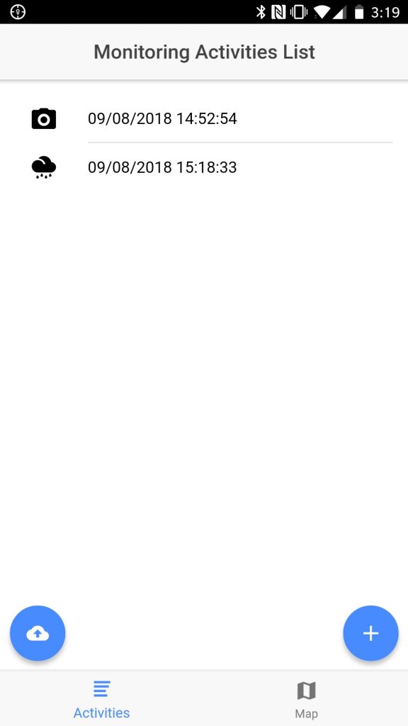
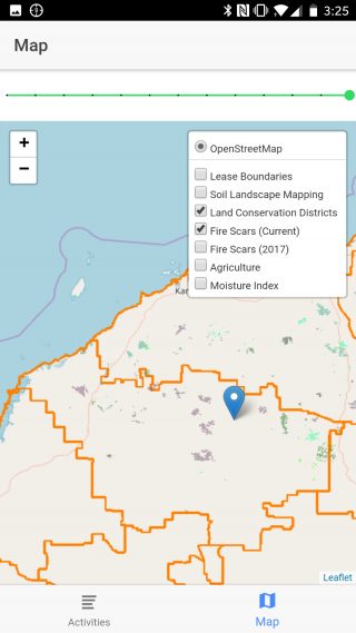
It’s a pretty basic app, but the bare bones we created in the weekend work pretty well, as shown below.
The Rangelands Rover app workflow allows the pastoralist to walk through data entry, photo capture, and map view.
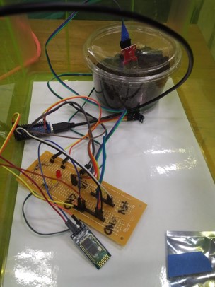
We also know we can add other resources to this app (e.g. Bureau of Meteorology weather conditions and trends, soil acidity, drone imagery) – but just not in a weekend! What we were able to add in the weekend though, was Bluetooth integration to a sensor that we put together with an Arduino board and some bits and pieces bought at the local electronics store.
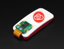
Voon-li’s sensor array and a container of soil we brought into test moisture readings (top), and an artist’s rendition of what the finished product could look like (bottom).
So the app is able to be used “offline” (without a data connection), contains Sentinel satellite imagery and other mapping layers, collects data from the soil moisture/temperature/humidity sensor that we created, photographs from the camera on the device, allows the user to enter other information from pick lists and date selectors, and publishes all the submitted data to GRID when back online via a data connection.
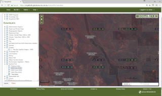
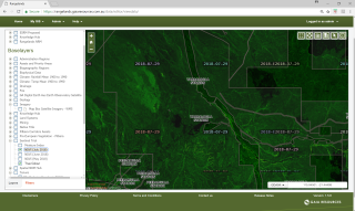
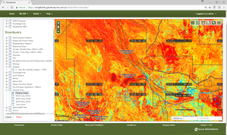
GRID displaying pastoral leases and Sentinal 10m resolution imagery. The 3 Sentinal views are True Colour (top), NDVI or vegetation condition (centre) and Moisture Content (bottom).
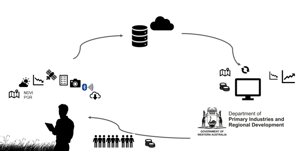
The whole idea was that we would provide a mobile mapping solution that becomes an indispensable tool to the pastoralist. When the pastoralist is then armed with this information across their lease (e.g. climate trends, weather, vegetation condition, time series satellite imagery, soils data, infrastructure), they can make more informed and sustainable management decisions, while also improving the data right across the Rangelands.
An overview of the RangelandsRover concept
In a lot of ways, Rangelands Rover could be part of a win-win solution where the pastoralist gets information to combine with their local knowledge to better manage their lease and the regulator gets the much needed on-ground verification of what they can see happening on a regional scale through satellite imagery. Those of us that were in the weekend really thought we had a good proof-of-concept to build on – and that was echoed by the rest of the team when we re-pitched it to them.
The weekend was very, very intense, but to deliver all we did in that timespan was really an accomplishment, although we didn’t bring home any trophies. Since the hackathon, we’ve revisited our work, what we produced, and we’ve re-pitched it internally to our team to look at how we could improve our pitches in the future. Already we’re reviewing how the outcomes can really help our other work – we’ve already integrated a trial of Sentinel imagery into all of the GRID instances we operate.
To answer the question, did we have fun? We did, but we all needed some down time afterwards – it really was like running a marathon.
If you’d like to know more, or are thinking about a mobile mapping app for your own business, start a chat with us via Facebook, Twitter or LinkedIn, or email me directly via chris.roach@archive.gaiaresources.com.au
Chris

Well done guys. Great effort for a hackathon weekend.
Thanks Nick, the guys did a great job!
Can’t wait for a demo.
Cheers, Chris. We’ll have to do another one for you sometime!