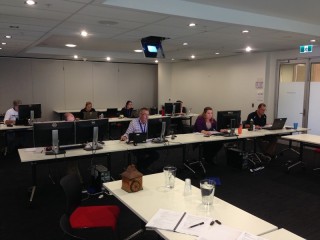
April seems to be the busiest month for QGIS training we’ve ever had!
QGIS training has been a very successful area for us, particularly with interest from environmental practitioners (you can see a web map here showing the distribution of our custom QGIS training locations to-date). We continually update our QGIS training course to ensure that we always train on the latest long term release version and I’ve recently just updated the course once again for the latest QGIS long-term release (version 2.14).
At the start of the month I was back in Albany alongside South Coast Natural Resource Management (SCNRM) Spatial Information Officer Nick Middleton. Together we delivered QGIS training to interested SCNRM staff that consisted of a recap from the previous two day course with additional bespoke training. In this section, we looked at the integration of QGIS with their project management tools and their GRID system (along with some advanced raster symbolising and processing for the super keen).
Then, I ran some slightly different – and very custom – QGIS training. This was a day of very interactive training with the GIS team from the Department of Fire and Emergency Services (DFES), held at the Emergency Services Complex in Cockburn Central. The DFES GIS team were interested in learning a new tool to add to their already extensive armoury, so this was really a ‘train the GIS professionals’ type course. This included a comparison of their existing systems to see how QGIS could be integrated.
The DFES team were impressed with the extensive library of tools and algorithms, which is quickly approaching over 1000 tools – and all freely available! Additionally, QGIS connected seamlessly (read and write) to their SQL Server database, and coupled with QGIS’s offline editing mode there is great potential for it to become an important part of the DFES GIS capability.
Before the month is out I will also be back with the team at the South West Catchment Council. This will be a tailor made course to streamline the link between field work and reporting using GPS, QGIS and GRID.
In addition to these types of custom courses we also offer a commercial QGIS course here at our Leederville office. Click here to find out more but we are planning to offer a commercial course at the end of May 2016. You can register your interest in the course by emailing training@gaiaresources.com.au.
Alternatively you can email me directly here or contact us via Twitter, LinkedIn or our Facebook page.
James


Comments are closed.